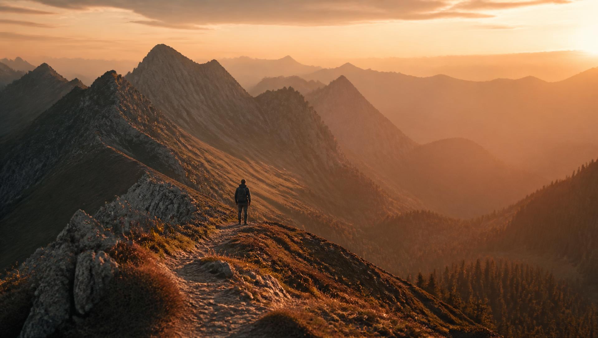
Pyrga, Cyprus · December 2024
Stavravouni Trail
A December climb toward the monastery — cold hands, warm light, and a viewpoint that made the whole year feel smaller.
Car-free access to the start
The walk after the bus
- Nearby bus stop in the snapshot
- Timios Prodromos Church
- Estimated access walk
- 3.58 km · ~50 min
- Walking-distance indicator
- Moderate
This is the connection to the hike's start, not the full hike. A nearby stop does not guarantee a bus at your chosen time.
Sources and missing information
- Access source
- Stored walking-route estimate and official bus-stop snapshot
- Hike recorded
- December 2024
- Transport story checked
- Not documented
- Access snapshot verification date
- Not documented
- Access-walk ascent
- Not documented
- Access terrain and road safety
- Not documented
- Access water availability
- Not documented
- Bus service frequency
- Not documented
Distance is not a safety rating. Check current buses, access, weather, daylight and water; remote or hazardous terrain may require turning back.
8.36 km
Distance
414 m
Elevation gain
Stavravouni
Peak
One day
Duration
Hill
Terrain
December 2024
Date
Easy
Difficulty
Very strong
Mobile signal
Overview
The story of this trail
This is one of the first hikes I organized for the hiking club. I had become its president during the 2024-2025 academic year, and Stavrovouni was only our second outing: the first one gathered four people, this one seven of us in total, me included. My plan was simple — put the group straight onto the marked paths that cross this hill, the E4 and the Agia Varvara–Stavrovouni trail, and walk them as marked.
The trail itself had no opinion about who was standing in the circle. A marked path stays a marked path, and its steep part stays steep. But not everyone in the group had proper shoes, and not everyone had the same legs. I could have kept going and let the hill sort it out — that is what a fit person does on a marked trail — or I could have changed the plan.
So I changed it. We turned onto dirt roads that gained height gradually, at a pace a conversation could keep up with, and left the sharp work for the end. That means the line we walked is only partly a designated trail: it borrows the E4 and the Agia Varvara–Stavrovouni path where they cross the hill, and the long middle of the walk is dirt road climbing at about 5% on average. The recorded route still shows the choice — only about 700 metres of the day is genuinely steep: the last 0.75 km, 160 m up at around 21%. The direct line would have handed us 1.64 km of continuous uphill instead.
That cost nothing that mattered and bought the only thing I was after. All seven of us reached the viewpoint at the top, the one that made the whole year feel smaller, and nobody had to be waited for. The trail was supposed to be the point of the day; in the end the point was that everyone got there. I have carried that into every route I have planned since — a hike that only suits the fittest pair of legs in the group is not a hike, it is a test.
The route
Milestones from start to finish
Stavravouni Trail
Drag to move · scroll to zoom
Elevation & steepness
350–623 m
Distance
8.36 km
Elevation gain
414 m
Elevation loss
150 m
Highest point
623 m
Lowest point
350 m
Steepness by distance
Major climbs & descents
The most significant sustained climbs and descents along the route.
Major climbs
Major descents
Road type
How the route is classified across its full distance.
Weather at the trailhead
Loading the forecast…
Sun & shade through the day
Sun & shade mixShade category · from mapped tree cover along the routeCurrent date and time: …
Working out the sun along the route…
From the trail
Moments from the walk
A gallery of the walk — the views, the surprises, and the quiet moments — will be added here.
Trail notes
If you're planning to walk it
Access
The start is a 3.6 km flat walk from the bus stop at the church in Kornos (buses 53 and 410). The finish sits 7 km from the nearest bus stop — plan the way home, or expect a long walk at the end of the day.
Read more
Two lines pass the church at Kornos — the 53, which runs between Pyrga and Alampra Bus Station, and the 410, which comes in from Larnaca through Kalo Chorio, Agia Anna and Psevdas — and this site measures the access walk from that stop: 3.6 km, about 50 minutes, and close to flat, since the stop and the trailhead sit within about ten metres of height of each other, with only a shallow dip between them. On Monday to Wednesday and Friday the first bus in arrives at 05:24, then 06:24, 07:49 and 08:27; on Thursday the early 410 is replaced by one at 09:48. Saturday gives you 06:27, 07:12 and 09:22, Sunday 05:27, 06:57 and 08:22. The last bus home from the same corner leaves at 21:52 on weekdays, 21:07 on Saturday and 20:53 on Sunday, and at Alampra Bus Station the 53 meets the lines towards Nicosia while the 409 runs on to Larnaca. The thing people underestimate is the finish. The recorded route does not come back to where it started — it ends 266 m higher, on the mountainside — and the same routing puts the nearest bus stop 7.1 km from the finish, about an hour and a half of walking down. So either you accept a day of roughly 19 km on foot, or you arrange something else for the end of it.
Best season
Hike from autumn to spring. Avoid summer — there is little shade.
Read more
I walked it in December, and I would keep it in the cold half of the year. The hill tops out at 623 m, so there is no altitude to hide behind once the coast starts baking, and only three in ten of the samples along the route sit under mapped woodland — the rest is open path and bare ground, which in July means a long climb with nothing to sit in. Spring and autumn are the honest answer: the track holds a pace, the light is long, and the buses run often enough that a slow finish costs you nothing. December was better than I expected — cold hands at the top, warm light on the way down, and a stillness you don't get in March. What spoils a winter walk here is the ground and the clock. Two thirds of the route is unpaved and another third is natural ground, so after rain the same track that was dust in October is mud, and in December the sun is gone before five, which leaves less slack than the timetable does. If you come in summer, start before the sun is properly up and carry all the water you need.
Navigation
Where the route follows the E4, you will see E4 signs and waymarks, so those stretches are easy to follow. The rest of the line is our own diversion along dirt roads, which has no signs of its own, so carry the GPS track and check it at junctions where the dirt roads leave the marked path.
Water & food
Bring your own food and enough water for the whole walk, since there are no shops along the way. The one place to refill is the fountain near Stavrovouni Monastery at the top.
Partly designated route
This route only partly follows officially designated paths — the E4 and the Agia Varvara–Stavrovouni trail. For their official descriptions, see Monopatia.info. The recorded route, bus access, walking gap and sun exposure on this page are by Hiking Against Distance.
Support this documentation
Keep car-free access information open to everyone.
Your support helps turn bus journeys and days on foot into freely available GPS records, photographs and access observations. Contributions help with field transport, food, water, equipment and publishing; the information remains free whether or not you contribute.
Buy me a coffee